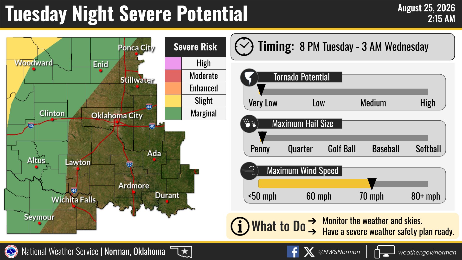
A complex of thunderstorms capable of damaging wind gusts could reach the Norman and Noble area Tuesday night into Wednesday morning, Aug. 25-26, according to the National Weather Service.
The NWS Norman office said on X that severe storms are possible across portions of Oklahoma and north Texas Tuesday evening and overnight, with damaging winds as the primary threat.
Norman is on the fringe.
The NWS Norman Area Forecast Discussion, issued at 6:06 a.m. CDT Tuesday, identified northwest Oklahoma as the primary target for strong to severe storms Tuesday night into Wednesday morning. Norman and Cleveland County sit on the southeastern edge of the forecast threat area, meaning storms may weaken before reaching the metro, but residents should stay weather-aware.
The storms are expected to develop in the Oklahoma and Texas Panhandles before spreading east-southeastward through the evening, according to the Storm Prediction Center's Day 1 outlook issued Tuesday morning. The SPC placed a Slight Risk of severe thunderstorms across parts of the central and southern Plains, listing severe wind gusts and large hail as the primary hazards. Some gusts of 75 mph or higher are possible in the highest-risk zone across southern Nebraska into Kansas, with the threat extending southward into the Oklahoma and Texas Panhandle region.
No specific arrival time for the Norman area has been issued. The NWS described the timing broadly as Tuesday night into Wednesday morning for northwest Oklahoma.
KWTV News 9 Chief Meteorologist David Payne noted on X:
@tornadopayne: "Near record highs again today with storms develop out west this evening. A few storms may be severe today/tonight with damaging wind gusts possible. Rain is possible in the OKC Metro Wednesday morning - midday."
Before the storms: extreme heat
Tuesday's weather brings its own dangers before any storms arrive. A Heat Advisory is in effect for Norman from 1 p.m. to 7 p.m. CDT, and an Air Quality Alert is also active, according to the NWS Norman local forecast. Conditions at Norman's Max Westheimer Airport at 7:45 a.m. Tuesday were already 79°F with south winds at 9 mph.
The NWS noted a weak frontal boundary near the I-44 corridor, with near-record heat expected south of it through the afternoon.
What to watch
The NWS may issue watches or warnings as the storm complex develops Tuesday evening. Residents should monitor updates at weather.gov/oun and on the NWS Norman social media accounts throughout the evening and overnight hours.