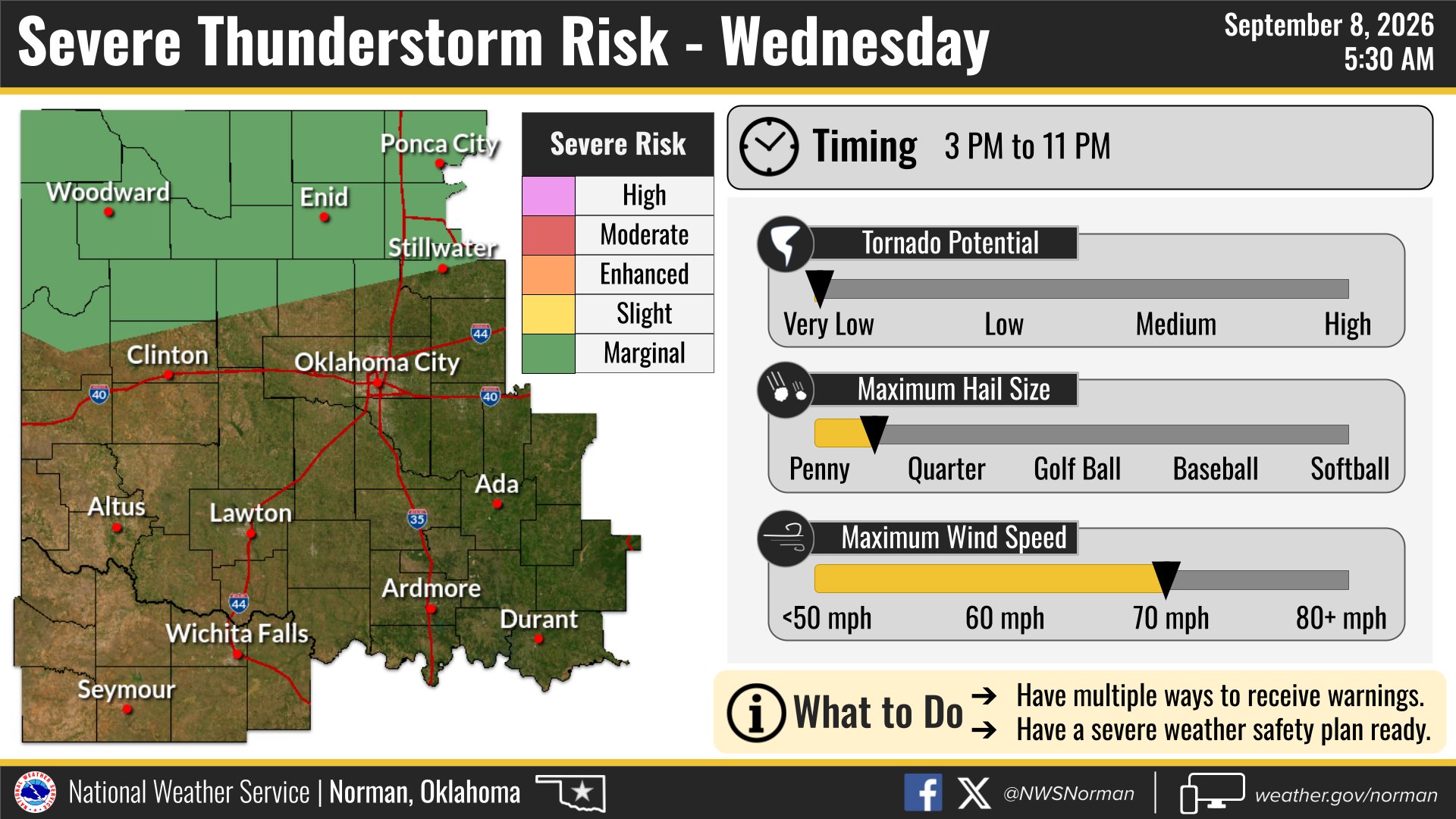
Severe storms capable of damaging wind gusts could hit the Norman area Wednesday afternoon as a cold front pushes through northern Oklahoma, the National Weather Service warned.
The NWS Norman office said on X Sept. 8 that the return of rain and storm chances Wednesday brings a risk of severe weather, particularly across northern Oklahoma during the afternoon and evening.
Damaging wind gusts are the primary hazard.
The front is tied to a Canadian low-pressure system forecast to sweep east of the Rocky Mountains late Sept. 9, according to The Watchers. The NWS has not specified wind speed thresholds for the expected gusts.
Heat stays dangerous until the front arrives
Before the storms roll in, residents face another round of extreme heat. A Heat Advisory is in effect for Norman through 7 p.m. Tuesday, and a second Heat Advisory runs from noon to 7 p.m. Wednesday, according to the NWS forecast page for Norman.
As of Tuesday afternoon, the weather station at Norman's Max Westheimer Airport recorded 100 degrees with a heat index of 102 degrees and south winds at 10 mph gusting to 20 mph. Heat index values across the region could reach as high as 108 degrees, the NWS said.
The NWS Norman office noted on X Monday, Sept. 7, that dangerous heat would persist through Tuesday and Wednesday with widespread triple-digit heat indices. The cold front should bring some relief by Thursday, especially across the northern half of Oklahoma.
How to stay informed
Norman residents can sign up for AlertNorman, the city's official emergency notification system powered by Rave Smart911, to receive free alerts by text, email or voice message. Residents and visitors can also text NORMANEVENTS to 226787.