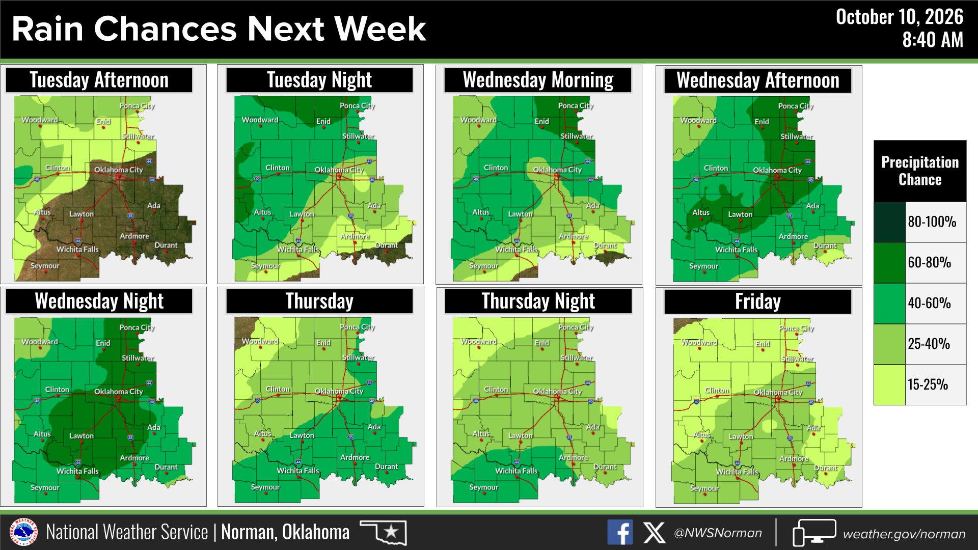
The National Weather Service in Norman is tracking a storm system that could bring storms Tuesday through Thursday, additional severe-weather potential Wednesday, flooding concerns and cooler weather following Thursday’s front.
Rain and thunderstorms are expected to develop across portions of western and northern Oklahoma on Tuesday afternoon, with precipitation chances climbing to 40% Tuesday night, NWS Norman said in a Saturday, Oct. 10, post. The heaviest activity is forecast to shift toward the I-44 corridor on Wednesday into Wednesday night, with lower chances lingering through Friday.
The agency placed the initial severe storm risk area across portions of northwest and western Oklahoma, according to a follow-up post. Norman is not explicitly inside that boundary as of Saturday, but NWS Norman said the risk area and rain chances will shift as the system develops and asked residents to monitor updates.
The NWS extended forecast for Norman shows a chance of thunderstorms Tuesday night, showers Wednesday and heavy rain Wednesday night.
Temperatures stay warm ahead of the storms. The forecast calls for a high of 89 degrees Tuesday and 86 degrees Wednesday, dropping to a low of 67 degrees Wednesday night. As of early Sunday morning, conditions at Norman's Max Westheimer Airport were fair with a temperature of 65 degrees, humidity at 78% and south winds at 9 mph.
News9 meteorologist Justin Rudicel reported Monday, Oct. 12, that showers and thunderstorms will begin developing in western Oklahoma late Tuesday, with enough atmospheric instability to warrant monitoring for severe weather. Bruns said rain and storm chances continue Wednesday and Thursday as the system pushes through from the west.
A stronger cold front is expected to arrive Thursday, bringing the coolest air of the season. Bruns reported lows could fall into the 40s with highs in the 50s and 60s. Some forecast models show temperatures dipping into the 30s by Sunday, Oct. 18.
NWS Norman recommended residents have a weather alert method in place before Tuesday and check the agency's forecast page for updates as conditions evolve.