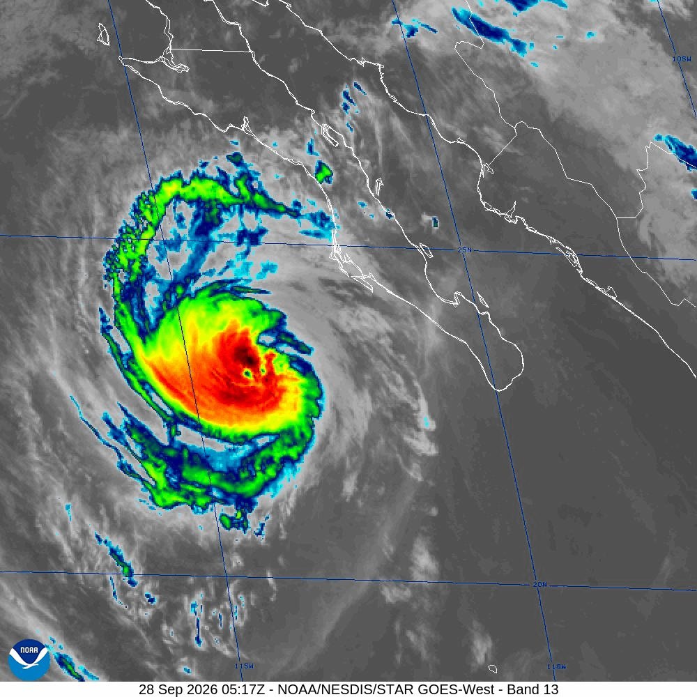
Norman could see its best rainfall in weeks starting Tuesday, Sept. 29, as remnants of Hurricane Polo push moisture into central Oklahoma through Friday.
The National Weather Service office in Norman forecast on Monday, Sept. 28, that rain will fall over most or all of its coverage area beginning Tuesday and lasting into Friday. The heaviest totals are expected Wednesday night and Thursday, with 1 to 3 inches or more possible in some locations.
The NWS warned that thunderstorms are expected to develop Wednesday afternoon and could persist through much of the night. With damaging winds and tornadoes the likeliest concerns, the NWS said. Large hail and very heavy rain are also possible, KLAW reported
The NWS upgraded the event to a Slight Severe Risk for western and southwest Oklahoma, KLAW reported on Sept. 28. The agency is encouraging residents to have multiple ways to receive weather warnings and to review severe weather safety plans.
Two weather systems are converging to drive the event. Oklahoma State Climatologist Gary McManus identified the primary drivers as an upper-level trough from the west and Hurricane Polo's remnants tracking from the southwest, the Oklahoma Farm Report reported on Sept. 28. McManus cautioned that the forecast "… will likely shift around, transmogrify, and morph into a different setup either subtly or enormously."
Polo reached Category 5 strength three times, twice with sustained winds of 180 mph, AccuWeather reported on Sept. 26. AccuWeather meteorologists expected 4 to 8 inches of rain from Monday through Friday in corridors stretching from the Texas Hill Country through southeastern Oklahoma.
News9 reported on Sept. 28 that the Oklahoma City metro area could see 1 to 2 inches, with 2 to 3 inches possible on the east side. Rain chances ramp up Wednesday midday and continue into Thursday.
The rain arrives with Oklahoma's soil moisture critically low. As of Sept. 20, 82% of Oklahoma topsoil moisture was rated very short to short, according to USDA figures cited by AgroLatam. Rangeland and pastures rated very poor to poor stood at 67% statewide.
Beyond the rain, residents can expect a sharp temperature drop. McManus projected highs in the 60s and lows in the 40s for the latter half of the week, while the NWS Norman forecast called for temperatures dropping into the 70s by late in the week.
The NWS Norman office is posting updated forecasts at weather.gov/oun as the system approaches.